
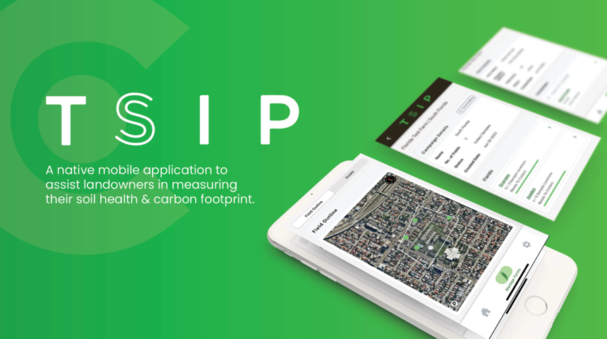
The Soil Inventory Project (TSIP) is a nonprofit collective advised by former Vice President Al Gore, focused on measuring and archiving soil carbon data across the United States. Their mission centers on equipping farmers with accessible tools to understand and improve soil health at scale.
As the organization grew, TSIP needed a purpose-built mobile application that could replace time-consuming manual testing methods and provide a public archive for soil carbon data collected in the field.
Farmers relied on time-consuming, fragmented testing methods to collect soil carbon data. The resulting data was siloed — not publicly archived or standardized — making it difficult to track soil health trends at a regional or national level.
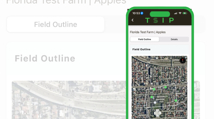
TSIP needed a mobile-first solution that could work reliably in the field, including areas with limited connectivity. The app had to guide users through the entire soil sampling process while capturing GPS-accurate location data and enabling offline functionality.
Core requirements for the platform:
Active Logic built the TSIP mobile app as a greenfield initiative, designing and developing the platform from the ground up as "a one-stop shop for the entire sampling process." The application was built with React Native for cross-platform deployment, backed by a Laravel and PostgreSQL API layer. The build was led by our Kansas City mobile app development team for offline-first field engineering across nationwide soil-sampling routes.
Integrated Mapbox for offline-capable GPS mapping, allowing farmers to define field boundaries, drop sample pins, and navigate to precise coordinates — all without an active internet connection.
Built a regional benchmark comparison engine that contextualizes individual soil sample results against aggregated data from the same geographic area, giving farmers actionable insights into their soil health relative to peers.
Developed the entire application in React Native to maximize code reuse across iOS and Android. A single codebase ensured consistent behavior across hundreds of compatible devices while reducing long-term maintenance overhead.
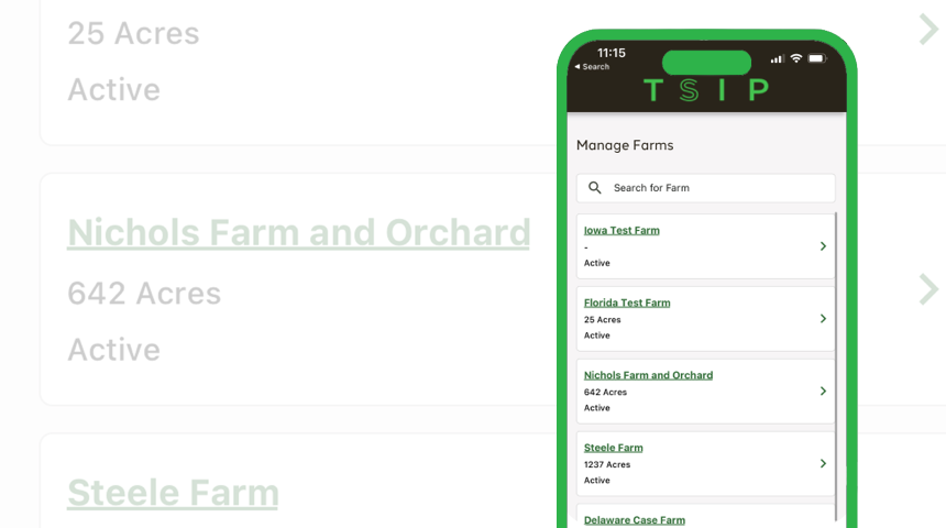
Active Logic invested 3,500+ hours of development into the TSIP platform, delivering a production-ready mobile application compatible with hundreds of devices. The app launched on both the Apple App Store and Google Play Store, providing farmers nationwide with an accessible, field-ready tool for soil carbon data collection and archival.
Talk to us about how Active Logic's senior engineers can take your greenfield project from concept to launch.
